
Albuquerque, NM
Denise Sloan
Denise Sloan/PCS Adventures
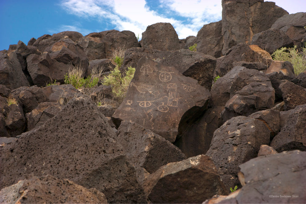
Petroglyphs National Monument contains thousands of drawings, both simple and complex.
I often add “just one more thing” to my road trip schedule. My theory: Surely we can squeeze in one more stop even if we don’t get to see everything.
This was the case the last time my Dad and I found ourselves passing through Albuquerque, New Mexico. I’d researched several great places and we squeezed in two of them. If you’re stationed at Kirtland Air Force Base, you can easily knock these monuments off your bucket list.
Petroglyph National Monument
We started at one of the largest petroglyph sites in North America. Petroglyph National Monument, home to more than 25,000 petroglyphs. The park lies just northwest of downtown Albuquerque.
We set the clock for three hours and we started at the Visitor Center to figure out the best spots to explore. The ranger invited us to watch a short video abut the petroglyphs and then suggest we start with the Boca Negra Canyon section.
Denise Sloan/PCS Adventures
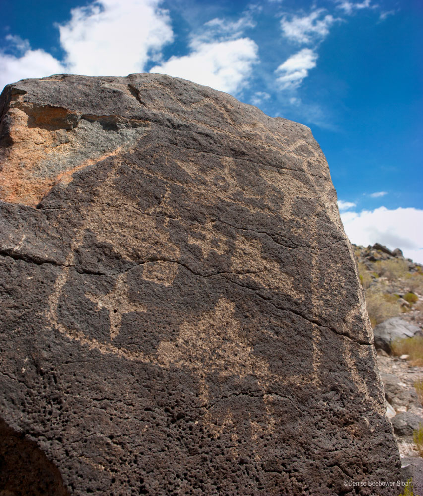
We found this set of drawings along the Mesa View Trail in Boca Negra Canyon.
The park is split into four main areas: Boca Negra, Piedras Marcadas and Rinconada canyons plus the Volcanoes Day Use Area. All of these areas show evidence of a volcanic activity thousands of years ago. In fact, the Volcanoes Day Use Area showcases the remains of three volcanoes often referred to as the Three Sisters.
When the volcanoes erupted, the cooling lava created lots of basaltic rock across a wide span. These rocks attracted Native Americans and later the Spanish. By carving into the dark rocks, people were able to expose the lighter colored rock below making it the perfect spot to “tell a story on the rocks”. Over a span of 400-700 years, thousands of petroglyphs popped up.
As I mentioned, we started in Boca Negra Canyon. It’s the most developed part of the park with shelters, a restroom and water. The short half mile Mesa Point Trail gave us our first look at petroglyphs and it didn’t disappoint! Not only did we see many drawings, we also got a nice look at Albuquerque from the top of the trail. Just FYI, this is a steep trail so make sure you can handle that before setting off.
Denise Sloan/PCS Adventures
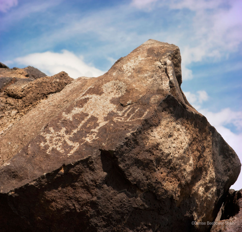
We found plenty of petroglyphs on the short Mesa Point Trail.
The ranger’s second recommendation took us to Piedras Marcadas Canyon. It’s a little surreal to be in Albuquerque one minute and hiking a sandy, petroglyph-laden trail the next. Since our time was running short, we hiked just a short distance on the petroglyph viewing trail before seeing the much anticipated petroglyphs.
If we’d had time, both of us would’ve loved to hiked the full 1.8 mile round trail. The ranger told us the route contained up to 400 petroglyphs! But, alas, getting to our next adventure in time to explore meant hitting the road for a drive an hour northeast of Albuquerque.
Kasha-Katuwe Tent Rocks National Monument
Much like Petroglyph National Monument, Kasha-Katuwe Tent Rocks National Monument developed thanks to volcanic eruptions and followed by erosion over time. The volcanoes deposited pumice, ash and tuff over 1,000 feet thick! Then the wind and water shaped rocks into hoodoos, strange spires of rock.
A tough cap on top protected the hoodoos from further erosion. When the caps themselves eroded, the hoodoos slowly transformed into tent-like figures. Today visitors can see hundreds of these fascinating tents, both well shaped and just starting to erode.
Hugh Beebower/PCS Adventures
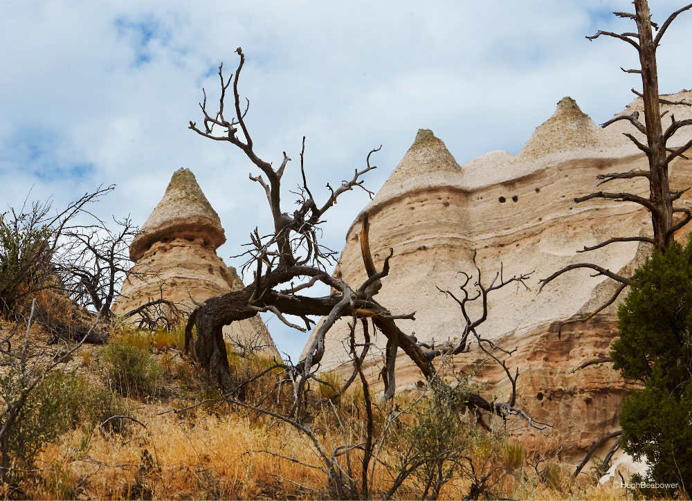
Views of existing and forming tent rocks make for a fascinating hike.
Dad and I opted to take the 1.2 mile Cave Loop Trail to get a broad view of the area. As we pulled into the parking lot we noticed storm clouds building far, far away. It looked like we’d have time for a short hike.
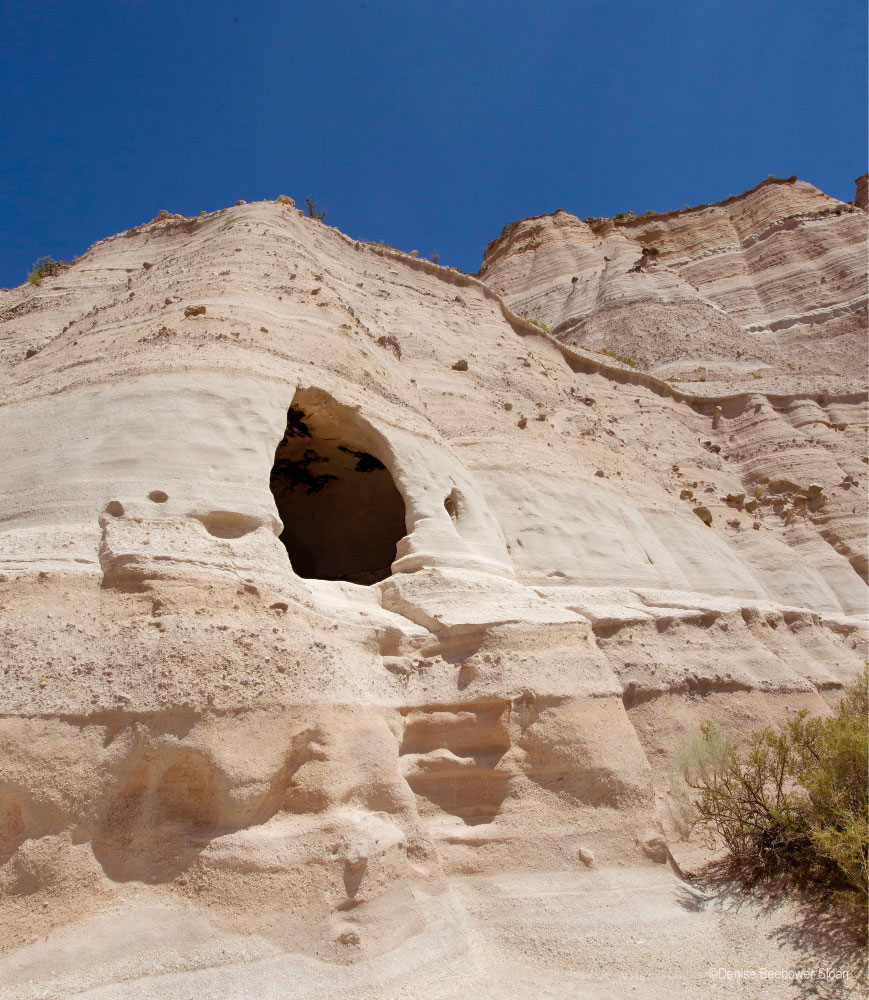
Denise Sloan/PCS Adventures
The eroding cliff walks included caves that are visible from the trail.
We set out on the Cave Trail, a 1.2 mile hike, and shortly began to see eroding white cliffs and fantastical cone shaped spires. About one mile down the trail, a brisk wind kicked up, cooling us off from the sweltering August temperatures.
Both of us have been out in the desert during monsoon season. We realized that wind might feel nice, but it could spell trouble. Dad kept one eye on the skies while I picked up the pace so we could at least get a panoramic shot before a storm hit.
Off in the distance, I heard a faint rumble of thunder. It galvanized me into action. I shot pictures like a paparazzi on a bender. Horizon line straight? Who cares? We can fix it in Photoshop. Just shoot, shoot, shoot!
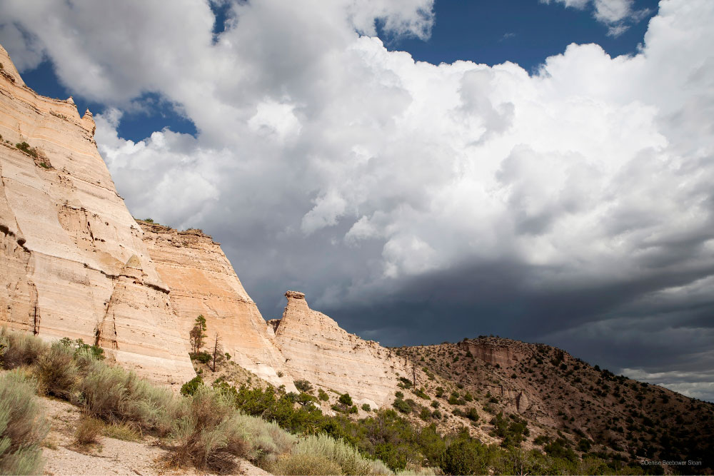
Denise Sloan/PCS Adventures
A giant monsoon thunderstorm rolls in over the mountains.
Then like the spaceship scene in “Independence Day” a very dark, very ominous cloud crested the ridge of the mountains and blotted out the sun. Our heads swiveled up and our mouths dropped open simultaneously. The cloud hovered over the far end of the mountains while throwing out lightening bolts left and right.
This wasn’t just a little rain shower. This was a storm. With little grace or coordination Dad and I raced back down the trail to the parking lot praying all the while that we wouldn’t end up on the evening news as fried photographers.
Just as the first big, fat raindrops hit us, we skidded to a stop at the van. We threw our gear in the back, jumped in and slammed the doors as the sky just opened up and all heck broke lose. That was one doozy of a storm—lightning, flooding and hail. The rain came down so hard we couldn’t see. But we felt blessed that we’d gotten photos and emerged unscathed.
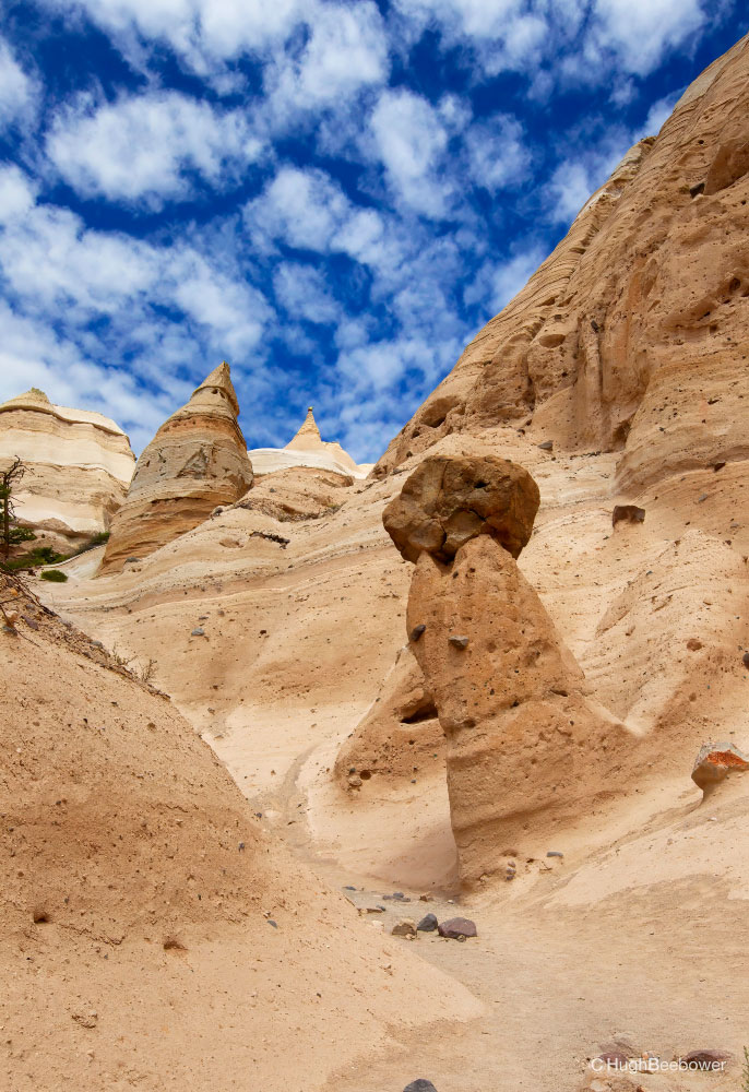
Hugh Beebower/PCS Adventures
The awe-inspiring tent rocks perched everywhere we looked, even on the side of the cliffs.
My Dad returned to the park a couple of months later and hiked the Slot Canyon Trail where he saw jaw-dropping scenes everywhere he looked. As the name implies, the trail does go through a slot canyon and eventually shoots hikers up, up, up to get a birds eye view of the entire landscape.
Even though we didn’t get to see “everything”, my Dad and I loved our two side trips in Albuquerque. In this case, something was definitely better than nothing! If you have the chance to see just a little bit of a place, take it. You’ll be building memories that you’ll treasure forever.
Closest Military Installations
MWR Locations Nearby
Kirtland Air Force Base FamCamp, NM 30 minutes
Fredericksburg, TX
If You Go:
- The Southwest swelters in the summer. Instead, plan a spring, fall or winter trip. If that’s not possible, plan an early morning trip for cooler temperatures. Be prepared with plenty of water, a hat and sunscreen. Let someone know where you’re going.
- Summer also means monsoon season. The weather can change from sunny and hot to stormy with lightening and flash floods in a heart beat. Stay weather aware.
Petroglyphs National Monument
- Stop by the Visitor Center if you’re unsure what trails to take. The ranger can help.
- There is little to no shade or services within the park. Come prepared with water and snacks.
- Spring, fall and winter are the best times to visit because they’re cooler.
- Albuquerque is a high crime city. Do not leave valuables in your vehicle while hiking.
Kasha-Katuwe Tent Rocks National Park
- The park is a joint venture between the Bureau of Land Management and the Cochiti Pueblo Tribal Land. To visit you need a reservation with the BLM for admittance and also a Cochiti Pueblo Tribal Access Pass. Directions on how to obtain the tribal pass will be provided when making the reservation online with the BLM.
- Military passes are accepted when reserving admission; however, they do not cover the tribal pass. Each person must buy the tribal pass.
- On the day of your reservation, meet the ranger at the Cochiti Visitor Center and follow the pilot car to the entrance.